There are more than 1,15,435 kilometres of national highways in India. As a result of increasing traffic on the road. The government set an ambitious goal of building 15,000 kilometres of roads in 2016-17, but only 8,200 kilometres were completed due to traditional construction and monitoring techniques. Drones might be used to monitor construction, speed up the process, and guarantee transparency, according to India's Prime Minister.
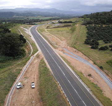
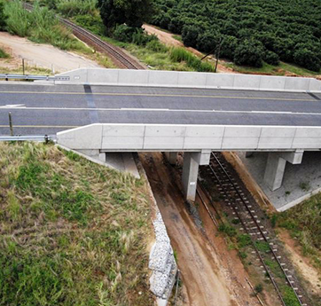
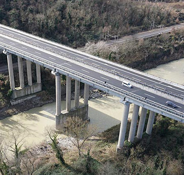
Using IG to monitor road construction Geospatial goods enable more effective building and maintenance of infrastructure projects, such as roads and bridges, using drones. Because effective inspection has a direct impact on the transportation network and public safety, early detection of fundamental flaws is critical. The Invent Grids platform provides an advanced tool for monitoring roads and bridges. Highway Corridor Mapping facilitates the following tasks: -detection of road defects such as potholes and fractures; -alignment of dividers, over line structures, boundaries; -expansion of highways; -power line crossings.